
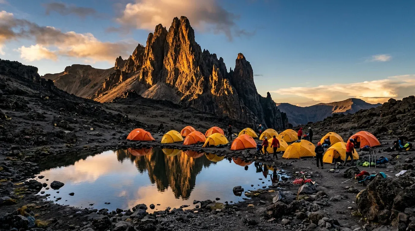
Kilimanjaro Rongai Route
The Remote Northern Wilderness Trail
The sole northern approach bordering Kenya’s Amboseli plains—offering drier rain-shadow weather, true wilderness solitude, and dramatic camping beneath Mawenzi Tarn.
Beginning near the Kenyan border on Kilimanjaro’s drier northern rain-shadow flank, the 7-day Rongai Route sees less than a fraction of southern trail traffic. Climbers enjoy sweeping views northward over Amboseli’s elephant plains, camp beside an emerald alpine lake beneath the jagged pinnacles of Mawenzi Tarn (4,330m), and descend via the lush southeastern Marangu trail for a complete north-to-south mountain traverse.
Day-by-Day Climb Itinerary
Rongai Gate (1,950m) → Simba Camp (2,625m)
Scenic drive around the mountain’s eastern flank followed by a quiet forest trek.
Simba Camp (2,625m) → Second Cave Camp (3,450m)
Steady ascent overlooking the vast plains of Amboseli in neighboring Kenya.
Second Cave (3,450m) → Kikelewa Camp (3,600m)
Gentle contour walk into a sheltered valley dotted with giant senecios.
Kikelewa (3,600m) → Mawenzi Tarn Camp (4,330m)
Camp beside an alpine tarn directly beneath the dramatic 5,149m rock spires of Mawenzi.
Mawenzi Tarn (4,330m) → Kibo Camp (4,700m)
Traverse the stark, silent saddle between Mawenzi and Kibo for early summit rest.
Kibo Camp → Gilman’s Point → Uhuru Peak (5,895m) → Horombo (3,720m)
Summit Uhuru Peak at dawn, then descend the southern flank to Horombo.
Horombo (3,720m) → Marangu Gate (1,860m) → Arusha
Complete your north-to-south mountain crossing and return to Arusha.
Reserve Your Private Rongai Route Summit Team.
Speak directly with Founder & CEO Matt Rupia’s team in Shangarai, Arusha. Every itinerary is built 100% around your dates, preferred lodges, and private pace—with a detailed proposal delivered within 24 hours.